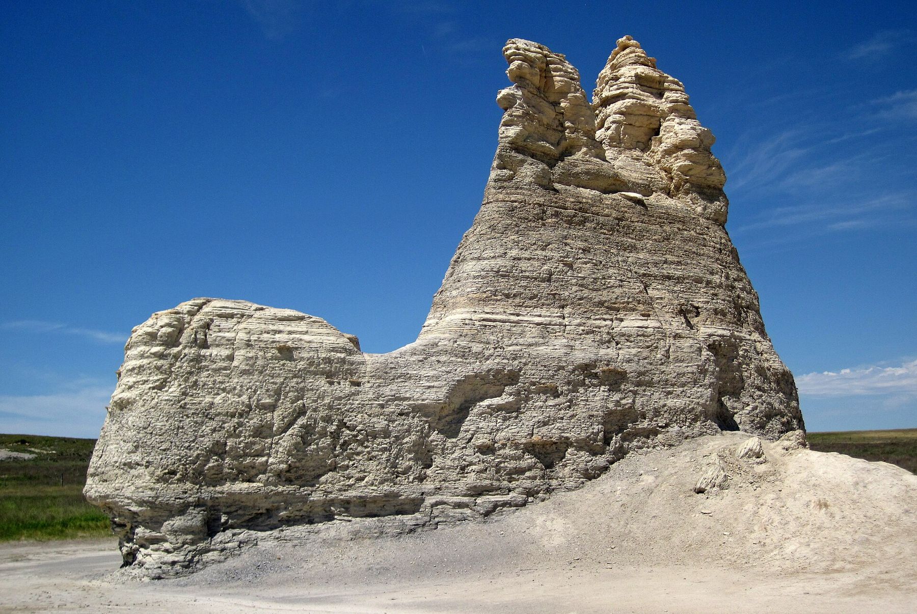
South of I-70 in Gove County a single chalk spire rises over a broken white bluff. It is fragile, on private land, and best seen in dry weather and low light.
The way in is county gravel and then a rough ranch track. Skip it after rain. Fuel and food are in Quinter or along I-70. Cell signal is patchy and there are no services.
A tower on the plain
Castle Rock is a single chalk spire standing over the valley of a small creek in Gove County, south of the town of Quinter. Around it, a long line of white bluffs and gullies breaks the shortgrass, the edge of what people here call the chalk badlands. From a distance the spire looks like the last tower of a ruined castle, which is how it got its name.
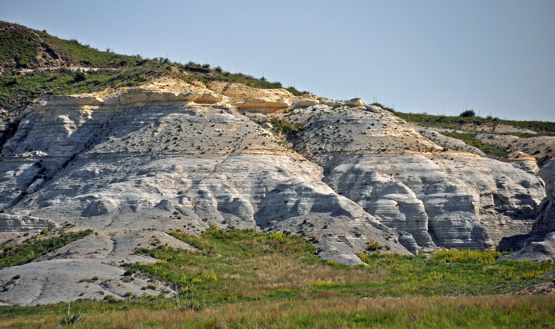
The rock is the same Smoky Hill Chalk that forms Monument Rocks farther west: soft, white sea-floor chalk laid down more than eighty million years ago, when a shallow sea covered the middle of North America. Streams cut down through it after the sea withdrew, and wind and water have been shaping what is left ever since.
A shape that keeps changing
Castle Rock has already changed within living memory. A severe thunderstorm in 2001 brought down part of the spire, and the tower that stands today is shorter and thinner than the one in older photographs. More will fall in time. Every freeze, thaw and heavy rain loosens a little more chalk, and the gullies around the bluffs widen year by year.
That fragility is the main thing to keep in mind when you visit. Chalk crumbles under hands and boots, and pieces drop from overhangs without warning. Do not climb the spire or the bluffs, do not dig at the rock, and do not carve or scratch names into it. Look, photograph, and leave it as you found it.
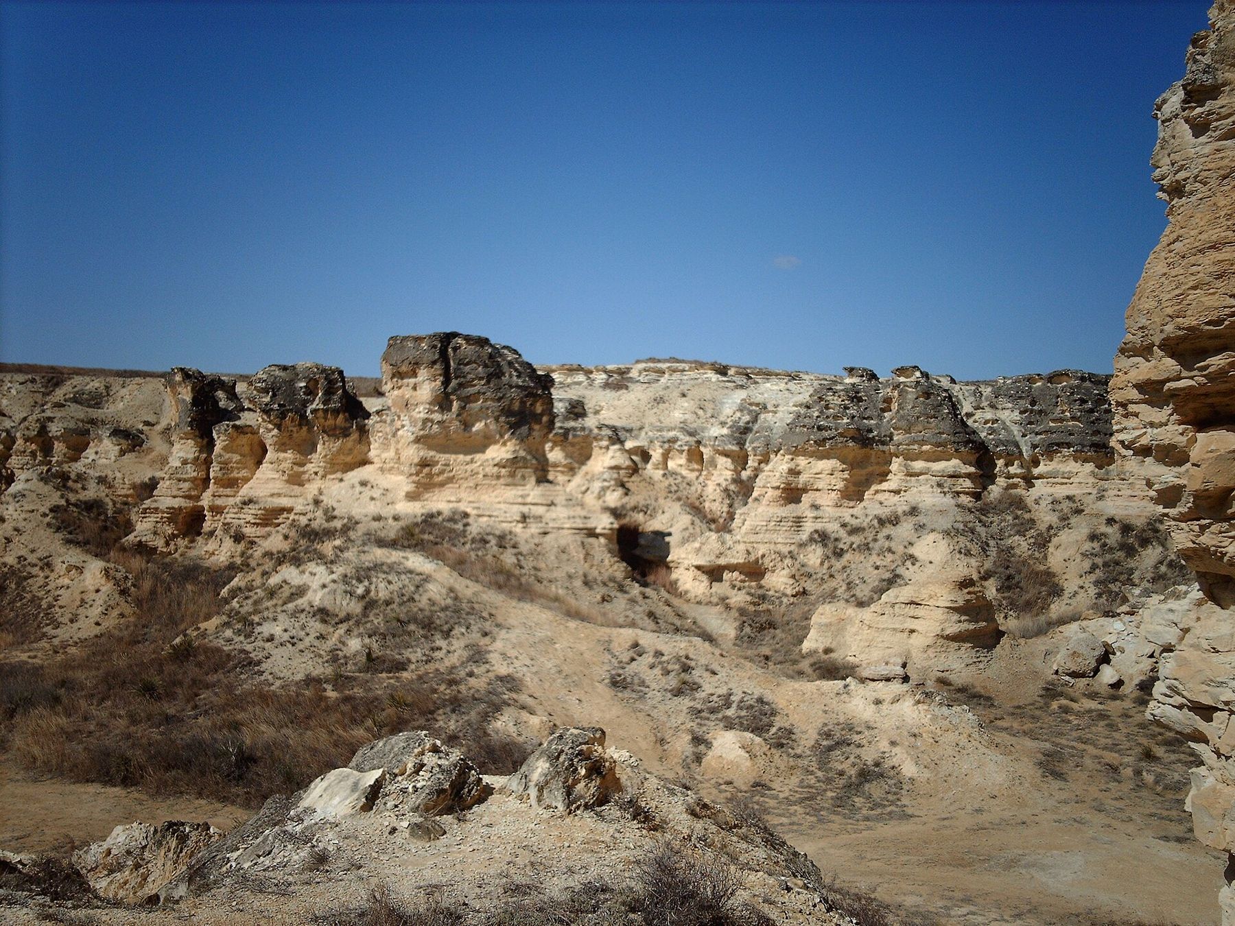
Badlands form where soft rock wears away faster than plants can hold it in place. Here the chalk lies close to the surface under a thin skin of grass, and once a gully cuts through that skin, every storm deepens it. The result is a maze of white ridges, fins and small canyons along the bluff, with yucca and tufts of grass clinging to the slopes. Walk the edges gently: the ground near the rim is often undercut, and the slopes are steeper and looser than they look.
Private land
Like Monument Rocks, Castle Rock stands on private ranch land. The owners have long let visitors drive in, but that access is a courtesy, not a right. Follow any posted rules, keep to the existing track, leave gates as you find them, and stay clear of cattle. No camping, no fires and no off-road driving. If a sign tells you the way is closed, respect it and turn back.
 Turn off hereBig sky at night
Getting there
From the Quinter exit on I-70, county roads lead south across open wheat and grass country. The last stretch is unpaved, and the final track to the rock can be rutted and rough. A normal car can usually make it in dry weather if you drive slowly. After rain, though, the chalk and clay turn to a slick, sticky paste that can strand a vehicle for hours, far from help.
Carry a paper map or download one before you leave the interstate, because phone signal can be weak. Tell someone where you are going. Fill the tank and bring water, since there are no services at the rock. The basics of driving the back roads apply here in full. Allow more time than the map suggests; gravel miles are slow miles, and dust hangs in the air behind every passing truck.
Weather and light
Western Kansas weather moves fast. On summer afternoons, thunderstorms can build from a clear sky in an hour, with lightning, hail and sudden heavy rain. There is no shelter at the rock. Watch the sky, follow official warnings, and head back to pavement and solid shelter early if storms are coming. Never try to chase a storm or wait one out on the bluffs. Read up on storm season on the plains before a spring or summer trip.
When the weather is fair, the light is the reason to come. The chalk is flat and glaring at midday. In the early morning and the last hour before sunset it turns cream, gold and pink, and the shadows show every ledge and gully. On a calm evening, with the grass gone gold and the spire dark against the western sky, the place feels very old and very quiet.
For photographs, a longer lens helps. It lets you frame the spire against the sky from a respectful distance and pick out the layers in the bluffs without walking onto them. Wide views work best from the slightly higher ground back from the rim, where you can take in the tower, the white badlands and the grass running out to the horizon in a single frame.
A chalk country day
Castle Rock pairs naturally with the larger formations at Monument Rocks and with the badlands park at Little Jerusalem, both farther west in the same chalk country. With an early start you can see all three in a long day, but each deserves time, and the gravel roads between them are slow. Hays, to the east on I-70, has a natural history museum with fossils from the chalk, including the great sea creatures that swam over this ground.
In spring and fall, the fields along the way turn green with wheat or gold with stubble, and the grain elevators in the small towns stand up like landmarks on the horizon. Take your time. The chalk has been here for eighty million years, and it is wearing away slowly enough to wait for you, but not forever.
Camera work
- James St. JohnCC BY 2.0
- NationalparksCC BY-SA 2.5